Hypro Mappers

Where We Matter

We offer a range of services across following sectors

Agriculture

Roads & Railways

City Planning & Mapping

Mining & Quarrying

Renewable Energy Resources

Power Line & Telecom

Utility & Infrastructural Inspection

Watch the Video

We are Hypro Mappers

Your consent is required to display this content from this source - Privacy Settings

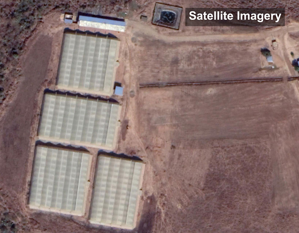
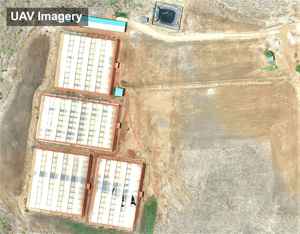
Drone imagery when processed into high-resolution Orthomosaics, DSM, Point clouds, etc. being high-resolution and accurate to cm level enables precise measurements for surveying and inspection requirements. Outputs processed from drone imagery have considerably higher resolution than satellite imagery.


Privacy Settings
We use cookies to enhance your experience while using our website. If you are using our Services via a browser you can restrict, block or remove cookies through your web browser settings. We also use content and scripts from third parties that may use tracking technologies. You can selectively provide your consent below to allow such third party embeds. For complete information about the cookies we use, data we collect and how we process them, please check our Privacy Policy
Youtube
Consent to display content from Youtube
Vimeo
Consent to display content from Vimeo
Google Maps
Consent to display content from Google
Spotify
Consent to display content from Spotify
Sound Cloud
Consent to display content from Sound